HMAP Atlas of Historical Fishing Grounds
HMAP is in the process of developing a global atlas of historical fishing grounds and synthesizing the work and data of all its research projects. This information will be used to develop global perspectives of how marine life and ecosystems in the oceans have changed over the long-term. The goals of the synthesis and mapping projects are to identify areas of historical human-environment interactions and assess the cumulative impact of fishing upon these areas or marine ecosystems.
![]()
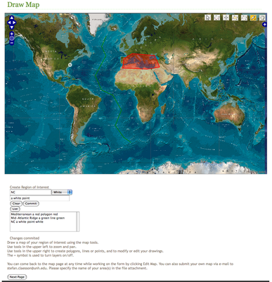
HMAP is in the process of developing a global atlas of historical fishing grounds and synthesizing the work and data of all its research projects. This information will be used to develop global perspectives of how marine life and ecosystems in the oceans have changed over the long-term. The goals of the synthesis and mapping projects are to identify areas of historical human-environment interactions and assess the cumulative impact of fishing upon these areas or marine ecosystems. In order to develop synthesis products, we have designed an online survey and Google Earth interface to solicit expert knowledge and historical assessments of HMAP researchers and participants. The survey requests participants to identify, map and characterize historical fishing areas, and describe changes in the conditions and trends in resource exploitation based upon quantitative or qualitative historical data. This information will ultimately be used to make inter- and intra-regional comparisons, map the spread of fishing technologies, identify patterns of behavior in human-environment interactions, and analyze the long-term resilience of specific marine species and ecosystems to fishing pressures. This project will not only provide synthesis products, but also will serve to preserve the legacy of 10 years of HMAP research.
Why create a global atlas of fishing grounds?
- Identify historically productive ecosystems.
- Provide spatial and temporal information against which to evaluate ecosystem and animal population change.
- Illustrate patterns of human exploitation.
- Compare ecosystem and marine animal populations within and across regions, as affected by climate change and human exploitation.
- Measure the resilience and relative health of ecosystems and specific fisheries over long time periods.
Applications:
- Identification of marine protected areas (MPAs).
- Establish levels or baselines for implementing restoration of deteriorated ecosystems and fish populations.
- Geographic and sustainability branding of fisheries: ‘Where is my fish from?’, ‘What fish is caught by sustainable and low-impact fishing methods?’
- Carbon footprint calculators: ‘What is the carbon footprint of eating a Chilean sea bass in London, UK?’
- Long-term climate change modeling.
- Scenario modeling.
Phase 1
Data collection: February 1 – March 31, 2009
Data compilation and mapping: April 1 – May 1, 2009
Phase 2
Web publication of baseline data and interactive fishing grounds atlas: June 1, 2009
HMAP ‘Oceans Past’ synthesis products: 2010.
Phase 3
Web publication of informational tools and calculators: to be determined.
To contribute to the synthesis work, please go to http://hmap.sr.unh.edu. For questions about this project and data entry access, please contact HMAP post-doctoral research fellow Stefan Claesson via e-mail (stefan.claesson@unh.edu).
